Unlocking the secrets of the sub-Antarctic underground
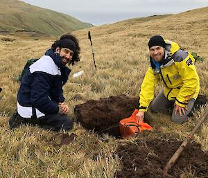
Finally, our long wait has come to an end. It is great to see the Australian Antarctic Division (AAD) Macquarie Island expedition team now installing our seismometers on the Macquarie island as part of the "Macquarie Ridge in the 3D" project. Comprising 27 ocean-bottom-seismometer locations, our passive seismic array is now being reinforced by five more land instruments on the island itself.
The AAD expeditioners, who will stay on Macca for one year, have had teams deploying to the field, carrying heavy equipment, digging holes and installing the seismometers. Five seismometers in total will be installed along the central axis of the 35 km long island. They will work simultaneously with the ocean component installed in October 2020 to record earthquakes and other phenomena passively and secure the best possible imaging resolution. You can see some incredible Macquarie Island scenery and further details of the project in the link below. Thanks to the AAD Macquarie Station team for enduring harsh weather conditions when installing our seismometers.
The Macquarie Ridge in 3D" project aims to advance the understanding of the Australia-Pacific plate boundary (the Macquarie Ridge Complex) in the Southern Ocean. It will be the first study to elucidate the processes generating the world's largest submarine earthquakes not associated with active subduction. This may lead to understanding how subduction initiates, the mechanism of earthquakes occurring at convergent margins, and more accurate estimates of earthquake and tsunami potential.
This study will keep Australia at the forefront of Earth Science research into the evolution of tectonic plates. These are all much-needed developments in these turbulent times for the Australian Earth sciences. The study will better inform hazard assessment efforts in the region, benefiting policy-makers and at-risk communities along the Australian coastline. 3D imaging of the central Macquarie Ridge Complex and Macquarie Island will be of immediate benefit for understanding the tectonic evolution of the Australian plate and the mechanisms responsible for earthquake generation in the region. The latter will enhance monitoring of the earthquake belts around Australia and provide more accurate tsunami potential estimates.
The results will be relevant to the seismological research community and national earthquake monitoring programs, such as those operated by Geoscience Australia and EQC/GNS New Zealand. The combination of the study area, deployment geometry, and imaging techniques will yield the complete seismic structural dataset available on Earth for evaluating processes controlling great strike-slip earthquakes in the oceanic lithosphere.
In November this year, we are going on a voyage to recover the ocean bottom seismometers installed last year. Most likely, we will sail on New Zealand premier RV Tangaroa. Stay tuned!
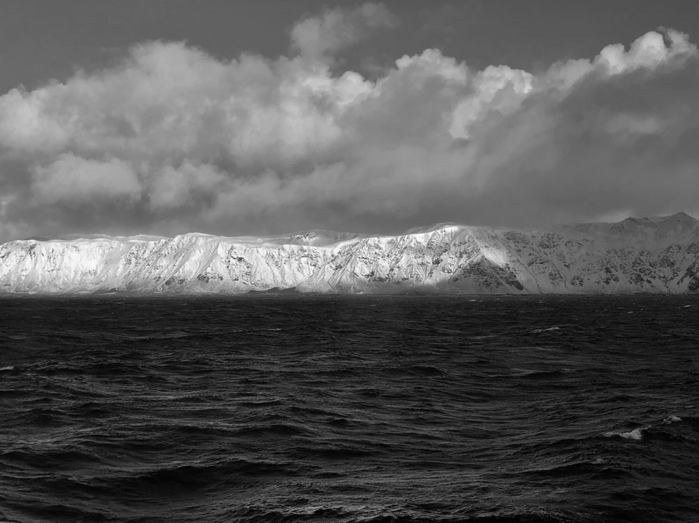
Photo: Snow-covered Macquarie Island, photo taken from RV Investigator, October 2020, H.T.
Edited by Louis Moresi