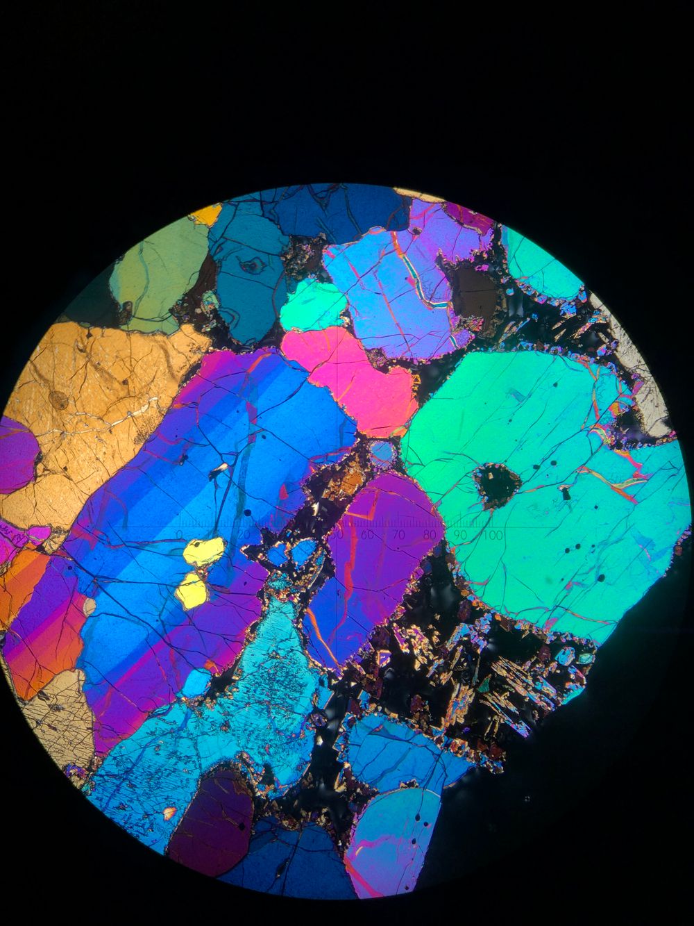
Photos from the field: the stunning crystals revealing deep secrets about Australian volcanoes
This article is republished from The Conversation under a Creative Commons license. Read the original article.
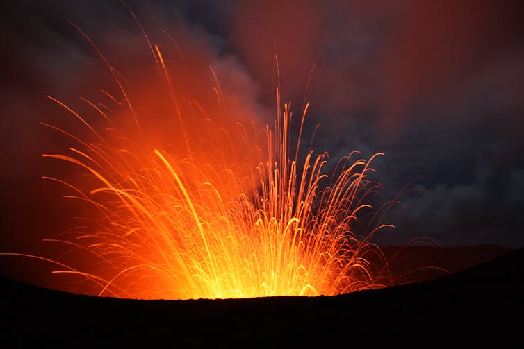
Volcanic activity is a constant global threat. It’s estimated over 1 billion people live within the potential, direct impact range of volcanic eruptions.
Just recently, lava flows from the eruption of Mount Nyiragongo, a volcano in the Democratic Republic of Congo, killed 32 people, with many more missing. Tens of thousands of people have been forced to flee the city of Goma.
This shows why understanding more about the inner workings of volcanoes is critical to improve the safety of those living in their shadows.
As a volcano scientist, my research takes me across Australia and all over the world. But sometimes, the most stunning revelations actually occur in the lab.
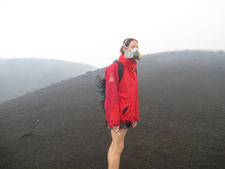
I take a microscopic look at volcanic rocks and fragments of the Earth’s mantle to estimate just how fast molten rock (magma) moves from deep in the Earth to the surface. This can help us prepare for future eruptions.
Australia’s fiery past — and future
Since the demise of the dinosaurs to recent human settlement, magmatic activity has left behind a trail of volcanoes stretching over 4,000 kilometres down Australia’s eastern margin, forming one of the world’s most extensive volcanic belts.
Read more: Australia's volcanic history is a lot more recent than you think
The last mainland eruptions took place at Mount Gambier and Mount Schank in South Australia around 5,000 years ago, a mere blink of a geological eye.
These eruptions were witnessed by local Aboriginal people and incorporated into oral traditions that have been passed down for hundreds of generations.
Based on the time since the last eruption, there are potentially two active volcanic regions in mainland Australia: in the northeast (southwest of Cairns) and southeast (from Melbourne across into South Australia).
The Mount Gambier and Mount Schank volcanoes are two of more than 400 volcanoes in the active southeast region called the Newer Volcanics Province, which has been active for at least the last 4.5 million years.
It’s considered likely there’ll be a future eruption in this province, but it’s not known when or where exactly the eruption will be.
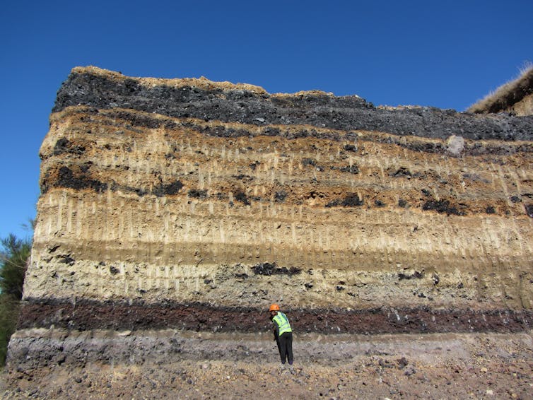
So how much warning time might we have?
To answer this question, we have to unravel the secrets held by past eruptions, now locked away in the erupted rocks and the crystals within them.
Our first clue is that many of the dark black volcanic rocks that erupted in the Newer Volcanics Province (and others) contain chunks of green rock, called peridotite.
These dense green rock fragments are, in fact, pieces of the Earth’s upper mantle that were plucked out by the rising magma and carried all the way to the surface from depths of greater than 30 or 40 kilometres below our feet.
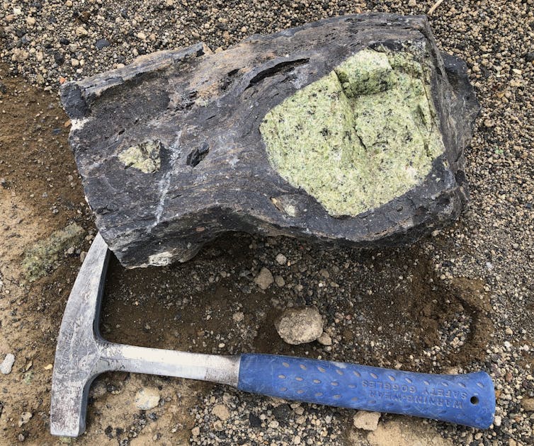
These fragments can sink back down through the liquid rock during its ascent, like a pebble dropped into a cylinder of honey. So in order to reach the surface, the rising magma had to move fast — likely taking just a few days from the source.
Volcanic crystal balls
In the same way tree rings can tell you about what the climate was like when the tree grew, the crystals within volcanic rocks and the mantle fragments they carry preserve memories of the environment on their upward journey through the Earth.
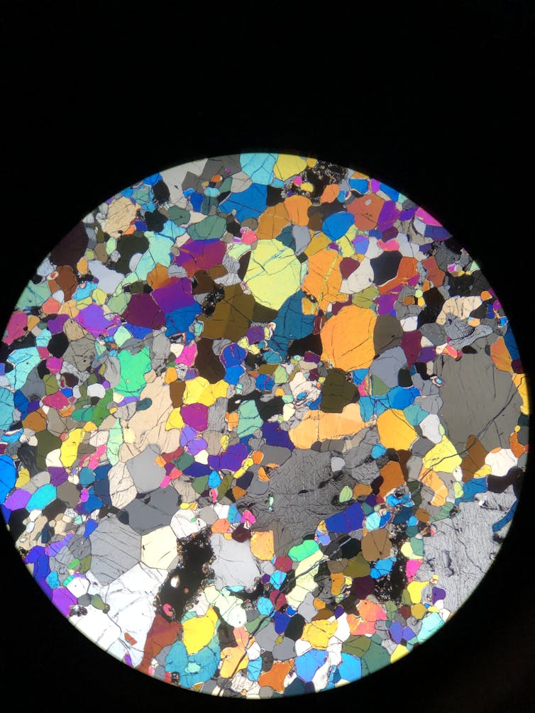
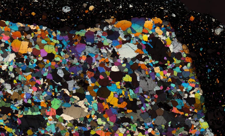
In the photo below, you can see how cross-polarised light passing through the mantle rock reveals a mosaic of colourful crystals. The darker part is the enclosing volcanic rock.
This thin slice of rock is just 30 microns in thickness, about half the thickness of a typical human hair.
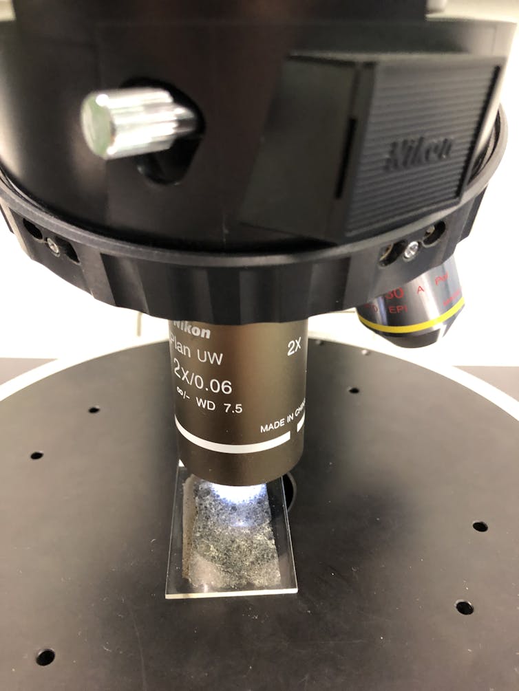
Now let’s take a look through a scanning electron microscope at the border where the mantle crystals make contact with the now-solidified magma.
In the two photos below, you can see the rim of the crystals has become lighter in colour, which means it changed its chemical composition. This is so it could adapt to its new magma environment on ascent in a process called diffusion.
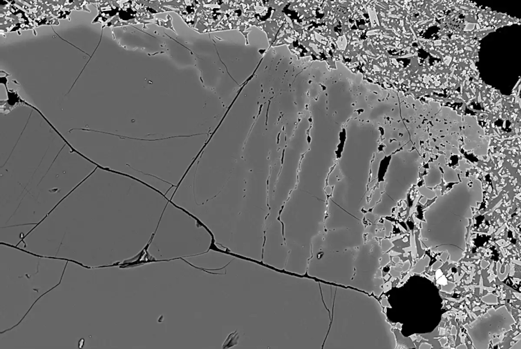
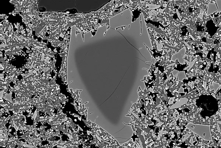
We use the sharpness of this chemical boundary to estimate how long mantle fragments sat in the magma before the rock erupted.
In other words, the minimum time magma took to travel from source to surface — an eruption warning time.
Read more: Curious Kids: Why do volcanoes erupt?
I can also use the chemistry and shapes of crystals that grew within the magma itself to map out the plumbing system beneath the volcano — the route magma takes to the surface.
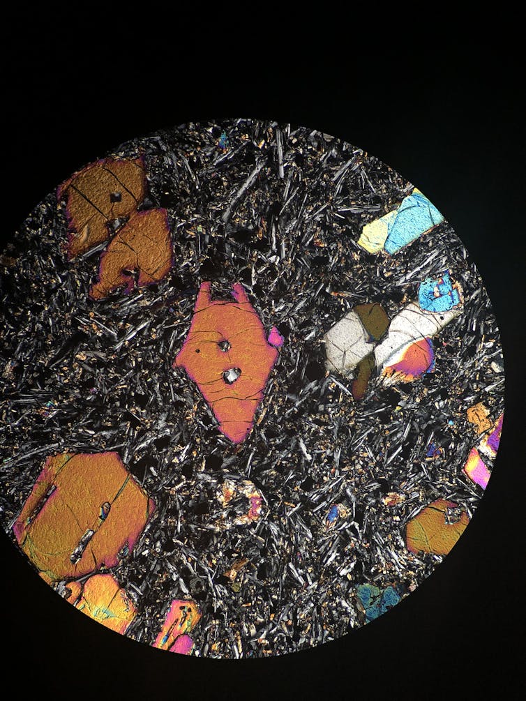
The photos below show some of the different shapes crystals can form as the magma rises to the surface, cooling along the way. The spiky and skeleton-shaped crystals grow when the rising magma cools fast and by a large degree.
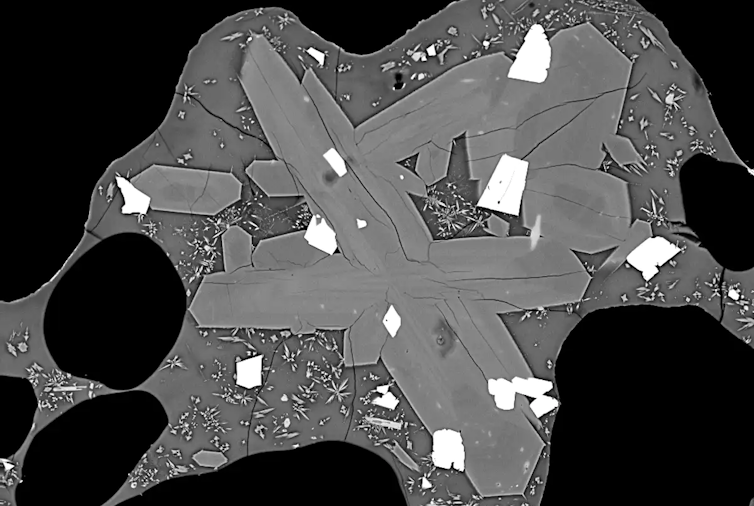
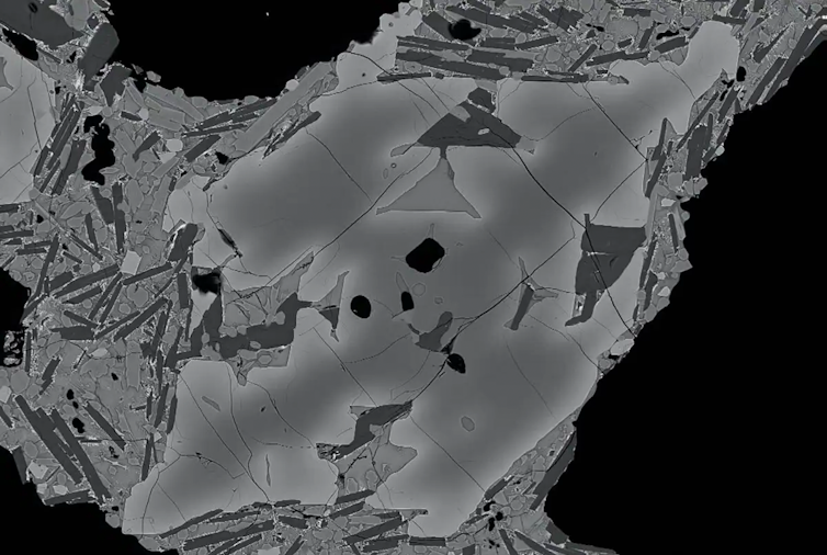
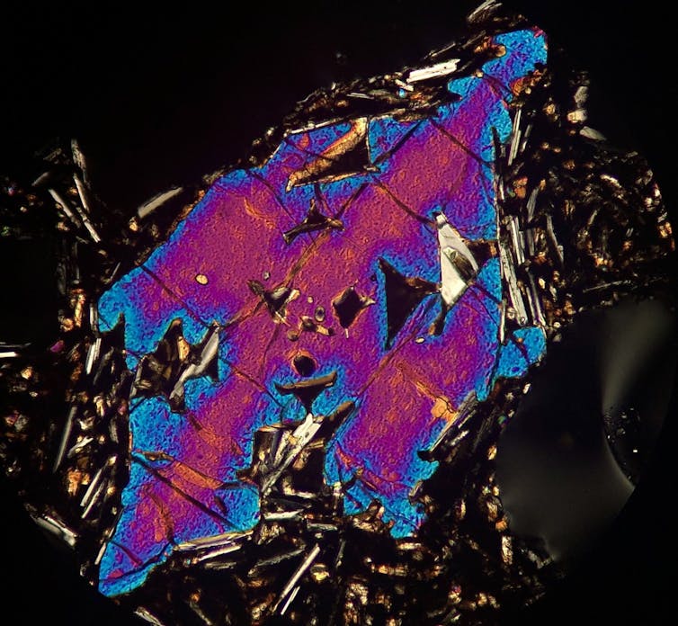
And we’re finding so far that individual volcanoes in the Newer Volcanics Province can take strikingly different pathways to the surface. This could result in varying eruption warning times.
Australia isn’t prepared
With likely maximum warning times of some past eruptions in Australia on the order of days, it’s worth considering how prepared we are for future eruptions — and not just from within Australia. If the global pandemic has taught us anything, it’s to expect the unexpected.
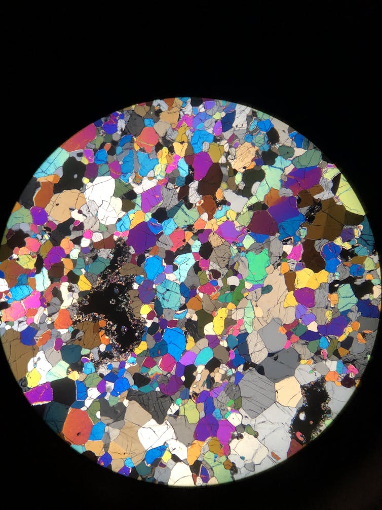
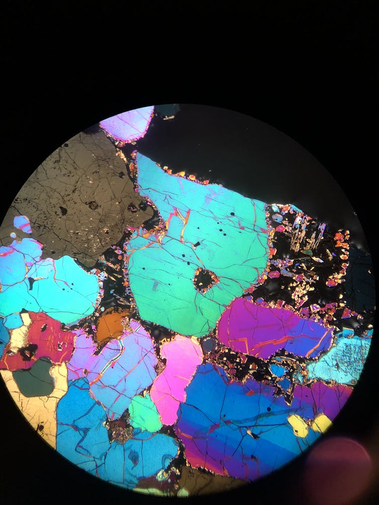
Large volcanic events are far from recent human memory, but in the Asia-Pacific region, they occur with a frequency of around every 400 years.
The federal government’s recent announcement of A$600 million towards establishing a new National Recovery and Resilience Agency will help Australia adapt to some climate change-associated hazards. But volcanic events appear to be excluded.
Preparing for the next potentially cataclysmic volcanic event in Australia’s neighbouring Ring of Fire should be part of Australia’s risk and resilience conversation.
Heather Handley, Honorary Associate Professor in Volcanology and Geochemistry, Macquarie University
This article is republished from The Conversation under a Creative Commons license. Read the original article.
